SOLAR POWER - ANd WIND POWER MONTENEGRO
Vuca ENERGY PARK
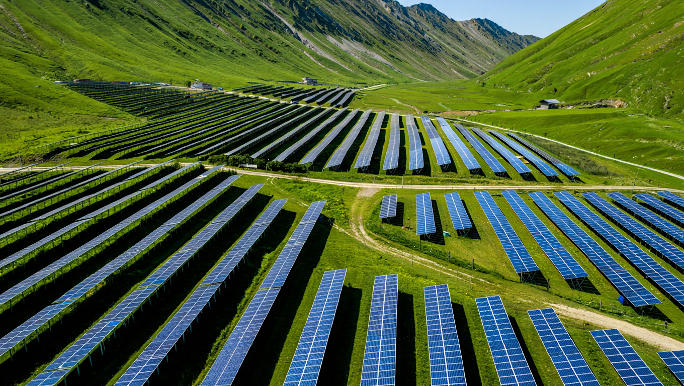
122,2 Mw (148mw dc) Solar Park
Solar Park (SP) Vuča is a system of 3 solar power plants with a total nominal installed power of 123.6MW. The planned construction site of SP Vuča is located near Rožaje, Municipality of Rožaje, Montenegro in an uninhabited location. For SP Vuča, the use of land with an area of approx. 194 ha.
Solar Park Vuča is located next to Vuča, in an uninhabited area, approximately 12.5 kilometers as the crow flies north of Rožaje, Montenegro The altitude of the planned positions of the solar park is about 1100 m above sea level. For the analysis of location and irradiation, the point of location SP Vuča is defined with the coordinates:42°55'12'' (42.92°) North 20°16'12'' (20.27°) East.
COSOVICA ENERGY PARK
37,5 Mw Wind FARM
The Cosovica Energy Park (EP) covers an area of 220 ha and consists of five wind turbines and eight solar power plants. EP Cosovica is located about 9.5 km northwest of the town of Rožaje and 1 km northwest of the town of Cosovica. The locality of EP Cosovica is located northwest of the town of Rožaje, on the border of the municipalities of Rožaje and Bijelo Polje. The border of the Republic of Serbia is about 6 km north
Solar power plants Čosovica consists of eight solar power plants: SE Čosovica 1, SE Čosovica 2, SE Čosovica 3, SE Čosovica 4, SE Čosovica 5, SE Čosovica 6, SE Čosovica and SE Čosovica 8.
The areas used for individual solar power plants are characterized by different topography, and therefore the distance between rows of photovoltaic panels is defined differently with the aim of reducing mutual shading.
Grid connection: Total estmated power to the grid: 84 MW. Inverter side rated AC bus voltage: 800 V, grid side voltage level: 20 kV. Inverter side total rated current: 2 500A. Transformers rated power levels: 3 300 kVA; 5 000 kVA and 6 600 kVA.
83 Mw WIND POWER PLANT COSOVICA
The georography of the location of the wind power plant (VE) within EP Čosovica and the surrounding area is presented using NASA-DEM data at a resolution of 1 arc second (30 m). In 2020, NASA released a global elevation model with enhanced digital elevation data through its NASA-DEM database. NASA has reprocessed the telemetry data obtained by the original Shuttle Radar Topography Mission (SRTM). This data was collected by Space Shuttle Endeavor during mission STS-99 which flew for 11 days during February 2000. This original telemetry data was reprocessed with improved algorithms and any missing (blank) areas were filled in with better data sources. A quality foundation is also available; this quality background can be found in the computer package windPRO. In principle, all land areas between 60N and 65S are covered — which corresponds to 80% of the Earth's land surface.